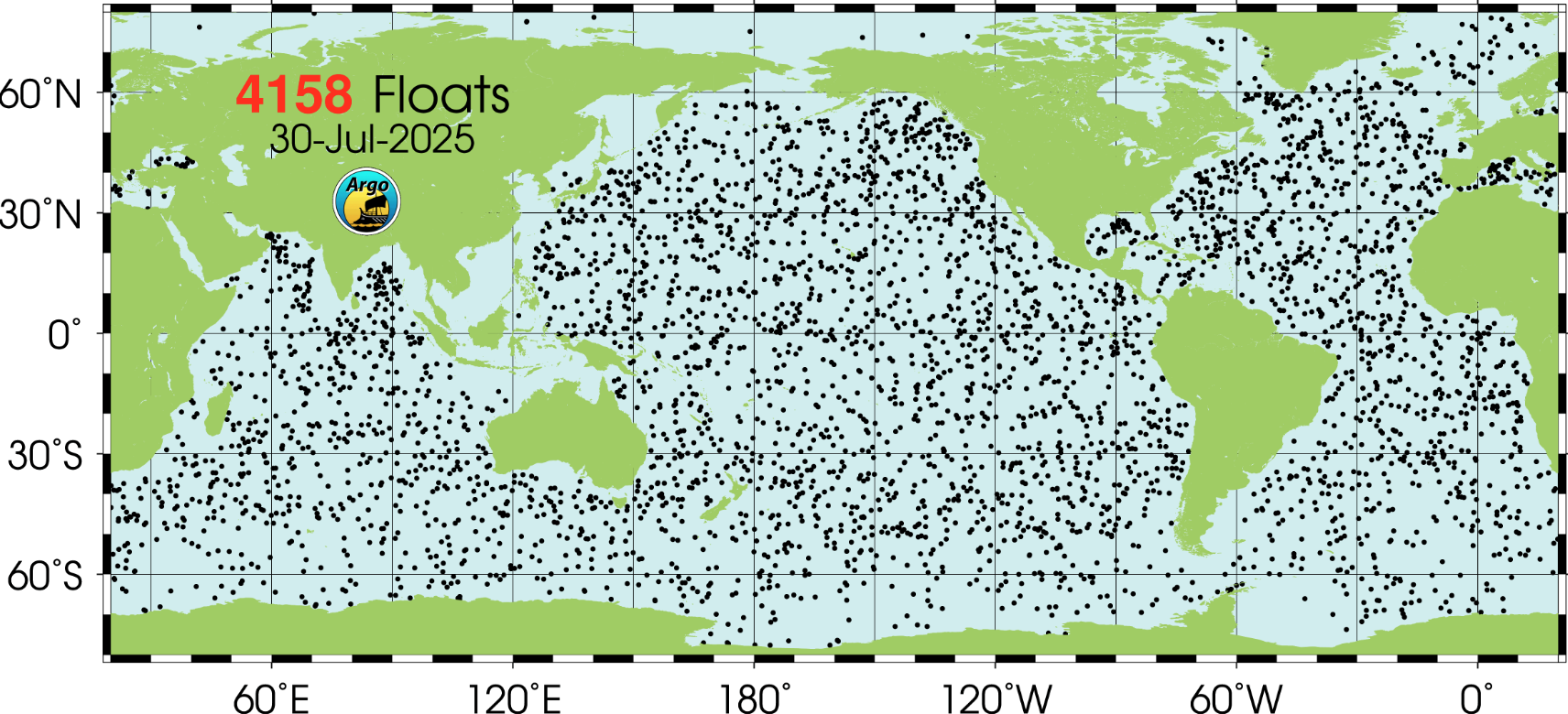
Data Sources
This page documents the native properties of the upstream products used in the project.
Use Depth Alignment for ARGO-to-GLORYS vertical resampling and Production Dataset for spatial and temporal dataset assembly.
Overview
| Source | Role In Project | Native Sampling | Key Variables |
|---|---|---|---|
| GLORYS | 3D ocean reanalysis field | global gridded field, fixed 50 depth levels | thetao, so, depth |
| OSTIA | daily surface temperature field | daily global 2D grid | analysed_sst |
| EN4 / ARGO profiles | in-situ temperature and salinity observations | profile-specific corrected depths | TEMP, PSAL_CORRECTED, DEPH_CORRECTED |
| Sea Level L4 | daily surface height and currents | daily global 0.125 degree grid | sea-surface-height fields, geostrophic currents |
| SSS MULTIOBS | daily surface salinity and density | daily global surface grid | sos, dos, sea_ice_fraction |
Product A: GLORYS Reanalysis
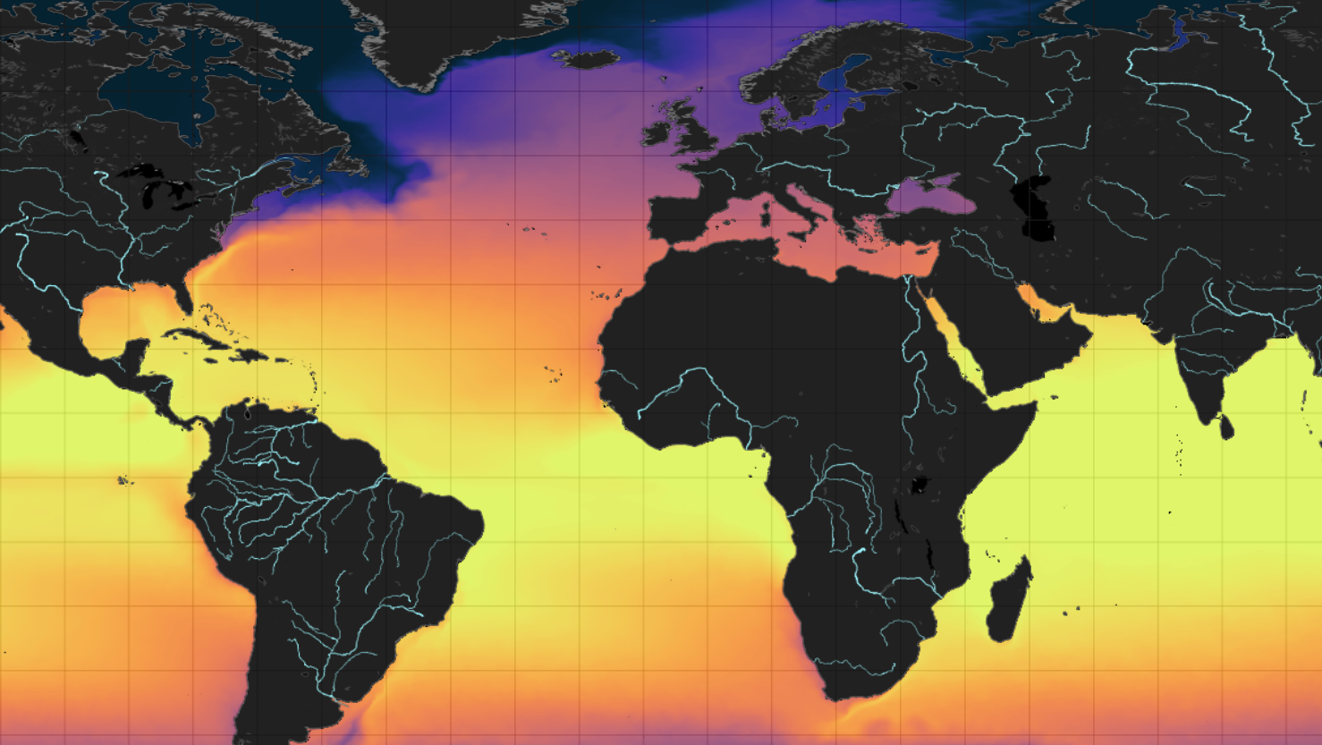
GLORYS is a global ocean reanalysis product that provides physically consistent 3D temperature fields on a fixed depth grid.
- Provider: Copernicus Marine Service
- Product family: Global Ocean Physics Reanalysis
- Source model used here:
MERCATOR GLORYS12V1 - Native variables used here:
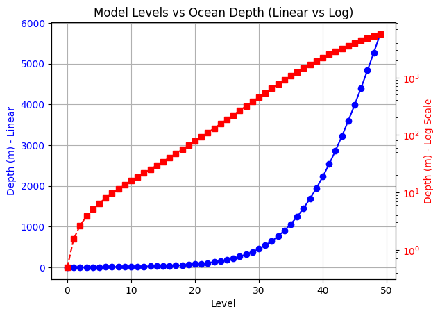
thetao,depth - Vertical coordinate: 50 fixed depth levels from roughly
0.494 mto5727.917 m
Relevant helper scripts:
- src/depth_recon/data/dataset_creation/data_download_raw/get_glorys/download_glorys_monthly.sh
- src/depth_recon/data/dataset_creation/data_download_raw/get_glorys/download_glorys_weekly.sh
GLORYS depth distribution:
Product B: OSTIA Surface EO
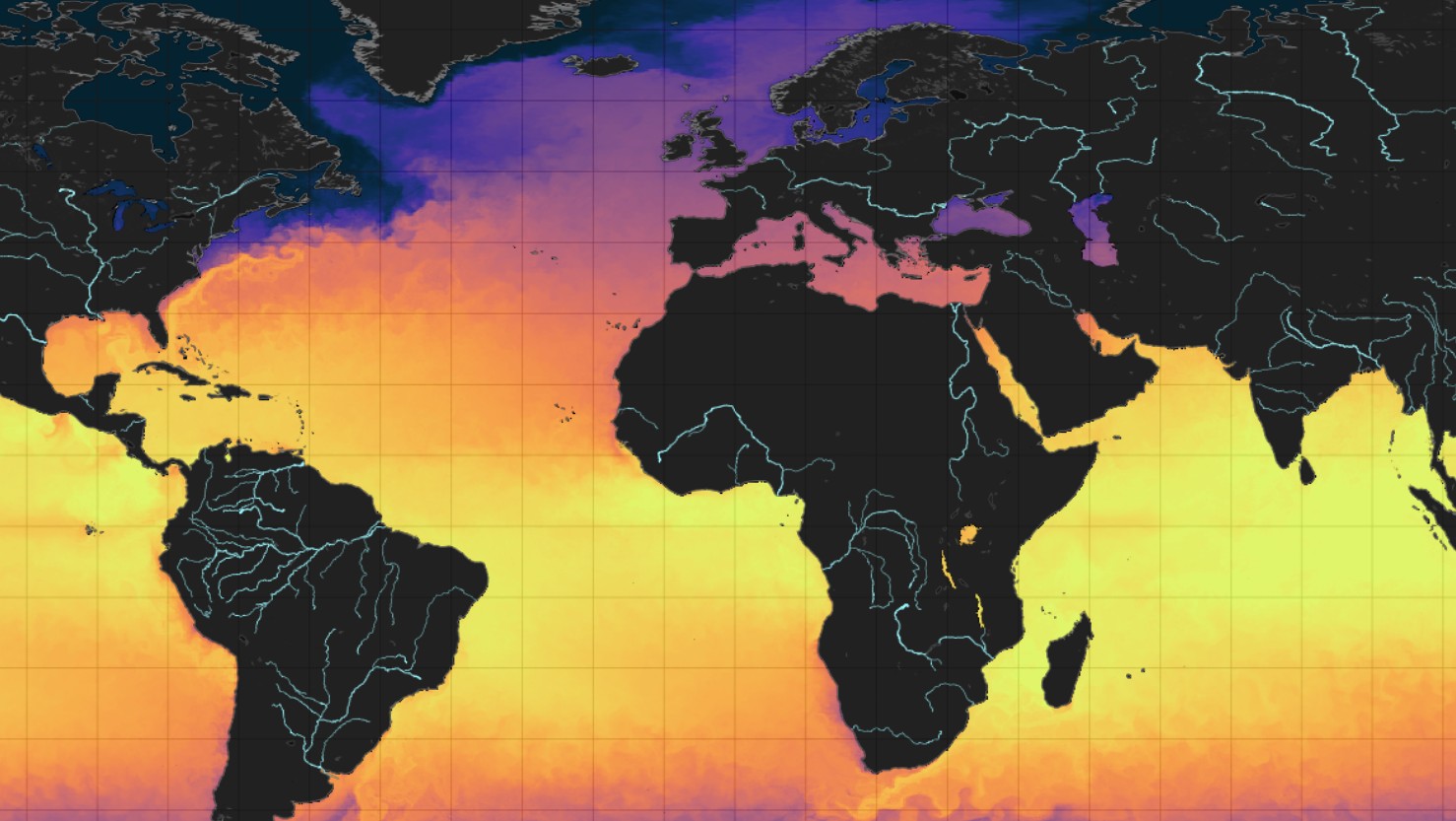
OSTIA is a satellite- and in-situ-derived ocean surface temperature product that provides daily global sea-surface temperature fields.
- Provider: Copernicus Marine Service / UKMO OSTIA stream
- Dataset used here:
SST_GLO_SST_L4_REP_OBSERVATIONS_010_011 - Native variable used here:
analysed_sst - Temporal sampling: one daily SST snapshot at
12:00 UTC - Geometry: global 2D grid
OSTIA example tile:
Product C: EN4 / ARGO Profiles
EN4 / ARGO provides in-situ ocean temperature profiles with irregular corrected depth samples that capture sparse but physically grounded vertical structure.
- Provider: UK Met Office Hadley Centre EN4
- Dataset family: EN4.2.2 profile archives
- Raw variables used here:
TEMP,DEPH_CORRECTED - Profile storage: rectangular arrays with capacity for up to
400profile samples - Vertical sampling: corrected depths vary profile-by-profile and are irregular in physical depth
Relevant helper script:
- src/depth_recon/data/dataset_creation/data_download_raw/get_argo/download_en4_profiles.sh
Archive-wide corrected-depth histogram with GLORYS reference levels:

- The histogram aggregates finite
DEPH_CORRECTEDvalues over the scanned EN4 archive. - Sampling density is concentrated in the upper ocean and decreases with depth.
- The dotted GLORYS depth markers show the discrete reference levels used elsewhere in the project.
Example ARGO profile in 3D:
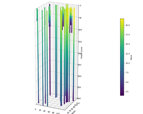
Important: z shows the netCDF dimension (400), not actual depth.
Product D: Global Ocean L4 Sea Level
The Copernicus reprocessed global sea-level product provides daily gridded sea-surface-height fields and derived geostrophic currents.
- Provider: Copernicus Marine Service
- Product ID:
SEALEVEL_GLO_PHY_L4_MY_008_047 - Dataset ID used here:
cmems_obs-sl_glo_phy-ssh_my_allsat-l4-duacs-0.125deg_P1D - Native resolution:
0.125° x 0.125° - Temporal resolution: daily
- Format: NetCDF-4
- Native variables include sea-surface-height fields and geostrophic currents.
Relevant helper script:
- src/depth_recon/data/dataset_creation/data_download_raw/get_sealevel/download_sealevel_daily.sh
Product E: Sea-Surface Salinity
The Copernicus multi-observation SSS product provides daily global surface salinity and density fields with ice-fraction layers.
- Provider: Copernicus Marine Service / CNR
- Product ID:
MULTIOBS_GLO_PHY_S_SURFACE_MYNRT_015_013 - Dataset ID used here:
cmems_obs-mob_glo_phy-sss_my_multi_P1D - Temporal resolution: daily
- Native variables used here:
sos,dos,sea_ice_fraction
Relevant helper script:
- src/depth_recon/data/dataset_creation/data_download_raw/get_sss/download_sss_daily.sh
Raw Product Notes
Representative raw GLORYS variables:
| Variable | Dimensions | Description | Units |
|---|---|---|---|
| bottomT | (time, latitude, longitude) | Sea floor potential temperature | degrees_C |
| mlotst | (time, latitude, longitude) | Mixed layer thickness | m |
| zos | (time, latitude, longitude) | Sea surface height | m |
| so | (time, depth, latitude, longitude) | Salinity | Practical Salinity Unit |
| thetao | (time, depth, latitude, longitude) | Temperature | degrees_C |
| uo | (time, depth, latitude, longitude) | Eastward velocity | m s-1 |
| vo | (time, depth, latitude, longitude) | Northward velocity | m s-1 |